Se pone muy severa la cosa por algunos estados del noreste de los EE.UU.
Major severe thunderstorm outbreak expected; U.S. drought intensifiesBy Dr. Jeff MastersPublished: 2:16 PM GMT en Julio 26, 2012
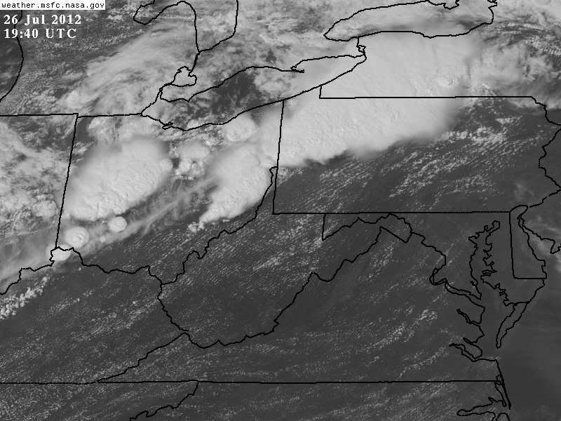
A dangerous outbreak of organized severe thunderstorms with strong, damaging winds is expected this afternoon from Ohio eastwards through Pennsylvania and into New England, says NOAA's Storm Prediction Center (SPC). They have put the region, which includes Columbus, Pittsburgh, Philadelphia, and New York City, in their "Moderate Risk" area for severe weather, just one notch below the highest level of alert. Much of the region is also under advisories for extreme heat, with temperatures in the upper 90s expected. This extreme heat will help energize the thunderstorms by making the atmosphere very unstable. A cold front passing through the region will trigger the severe weather episode beginning around 2 pm EDT this afternoon, near the Indiana/Ohio border. This front already triggered a round of severe thunderstorms early this morning across Michigan, which knocked out power to 16,000 customers. This afternoon, severe thunderstorms may organize into a complex that features a bow-shaped echo. If such a complex brings violent straight-line winds in excess of 58 mph (93 km/hr) over a swath of at least 240 miles (about 400 km), it will be called a derecho (from the Spanish phrase for "straight ahead".) The atmosphere is not as unstable as was the case for the June 29 - 30 Mid-Atlantic and Midwest derecho, however. That storm was one of the most destructive and deadly fast-moving severe thunderstorm complexes in North American history. It killed 22 people, knocked out power to at least 3.7 million customers, and did hundreds of millions in damage.
http://www.wunderground.com/blog/JeffMasters/article.html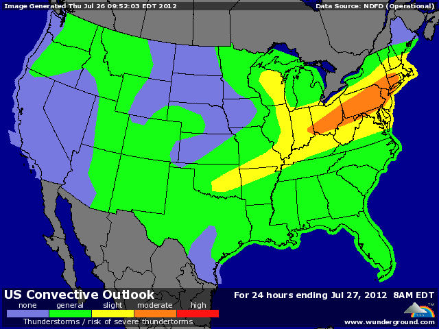

 474 Respuestas
 86393 Vistas