Cielos con nubes medias (Ac) dispersos, estos de ESTOFEX nos dan para hoy buen meneo...
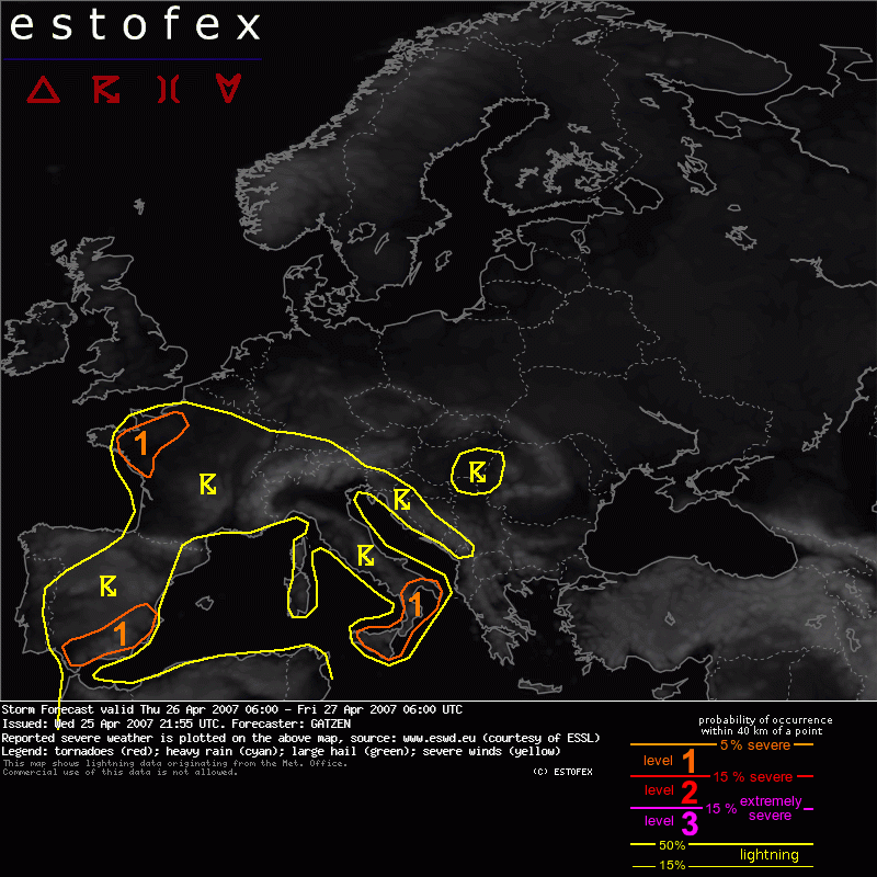
Iberian Peninsula
In the range of the developing cut-off low, widespread convective activity is expected to form. Given weak vertical wind shear over most places, only a small fraction of those cells may organize due to favorable interacting of outflow boundaries. Vertical wind shear will increase over south-eastern Spain, where upper jet streak moves eastward. Given 20 m/s DLS over this region, chance for some organized convective cells is expected to be higher. Although favorable veering profiles are not forecast, southerly surface winds and westerly winds aloft may create some helicity, and mesocyclones are not ruled out, capable of producing isolated large hail. Threat seems to be rather weak, though.
----------------------------------------------------------------------------
Si alguien puede traducir!!

Aunque a groso modo creo que hay amaneza debil de posibilidad de que al S y SE peninsular debido a las condiciones mas favorables de vientos se formen algunas tormentas mas organizadas con posibilidad de mesociclones.
 2135 Respuestas
 197449 Vistas